Aerial eyes on the roofs we can't walk
High-resolution drone imaging documents steep, tall, slate, and storm-fragile roofs across Hastings and Dakota County — close, detailed, and without a single footstep on covering that shouldn't be walked.
Some roofs simply should not be walked. The historic slate and clay-tile homes along Hastings' downtown bluff streets, steep Victorian gables near the Mississippi, three-story rooflines, and any covering left brittle by hail or wind all share the same problem: stepping onto them risks cracking material and risking the inspector. A drone roof inspection solves that. We fly a high-resolution camera close to the surface and document the covering, flashing, ridges, valleys, and chimney in detail — without a footprint on anything fragile.
What a drone adds to the inspection
Aerial imaging is not a replacement for a thorough roof evaluation — it's a tool that lets us complete one honestly when the roof is too steep, too tall, too slick, or too delicate to access safely. Instead of guessing from the ground with binoculars, we capture clear, dated, high-resolution stills and video of every plane. You receive those images in your report, so you can see exactly what we saw and make a confident decision on the home.
For lower-slope, walkable asphalt-shingle roofs, a hands-on walk is still the standard and is included in a full inspection. The drone steps in precisely when walking would do more harm than good — and on Hastings' older housing stock and tall rooflines, that's more often than you'd expect.
What we document from above
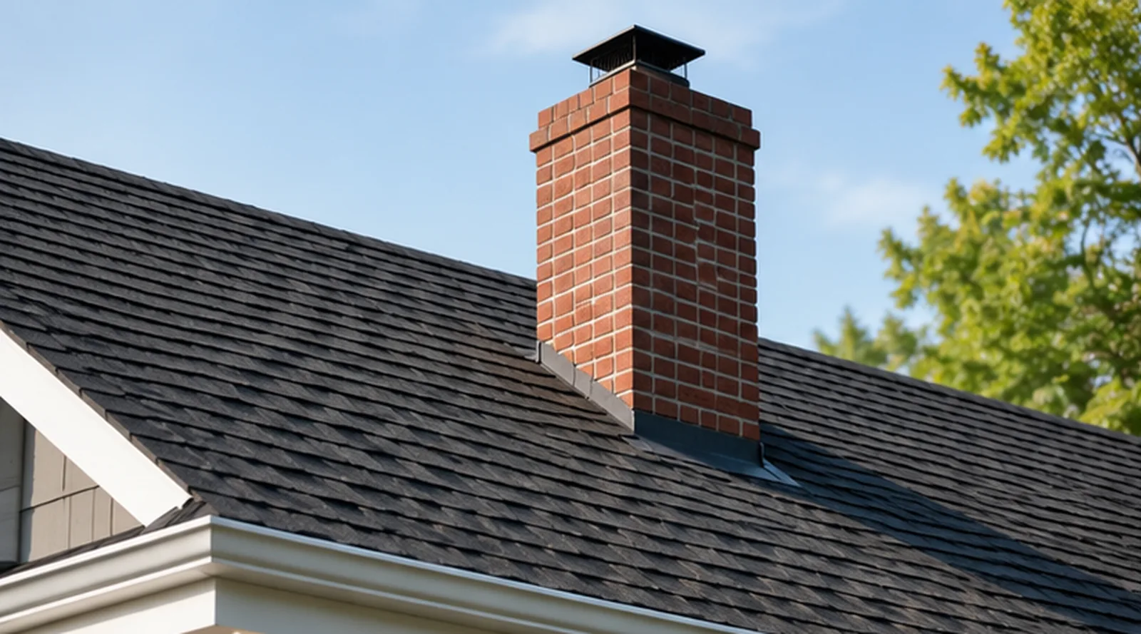
Every flight is aimed at the details that determine a roof's remaining life and watertightness:
- Overall covering condition — granule loss, curling, cracked slate or tile, and worn areas
- Ridges, hips, and valleys, where wear and water concentrate
- Flashing at chimneys, walls, skylights, and penetrations
- Chimney crown, cap, and masonry from a vantage you can't get from the ground
- Storm and impact damage from hail or wind — lifted, bruised, or missing material
- Gutters, drip edge, and roof-edge detailing where ice dams begin
All imagery follows the InterNACHI Standards of Practice and lands in your report within 24 hours of the inspection.
Why it matters in Hastings
Hastings sits on the Mississippi in Dakota County, and its housing tells two stories. Downtown and the bluff neighborhoods hold a remarkable concentration of older homes — steep gables, slate and clay tile, and tall, complex rooflines that were never meant to be walked. Out toward the newer developments, two- and three-story homes put a lot of roof a long way up. In both cases the roof is the most expensive system on the house and the one most easily misjudged from the driveway.
Minnesota weather compounds it. Freeze-thaw cycles and heavy snow load drive ice dams along the eaves, and summer storms regularly bruise shingles with hail or lift them with wind. Damage often hides on upper planes and around chimneys — exactly the places a drone reaches best. Getting close, dated imagery before you close means you're negotiating from fact, not from a guess. Pair this with our buyer's inspection for the full picture, and consider a dedicated roof inspection when the covering is your main concern.